Note: The Johnson Branch and the Isle du Bois Unit are in two different locations.
Johnson Branch
Trails: Dogwood Canyon and DORBA extension trails
Last hiked November 20, 2021
Trail Type: Hike and Bike
Distance We Hiked: 8.5 miles
Amount of Time it Took Us: 3 hr. 30 m.
Our Elevation Gain: 687 ft.
Park Rating: moderate
Mike & Elaine’s Rating: easy/moderate
Our Notes:
We parked at the Dogwood Canyon trailhead which had a restroom available before hopping on the trail. The Dogwood Canyon trailhead is at the left end of the parking lot and is not marked, but we had no trouble finding it by looking at our map. This is an out and back trail measuring 2.6 miles one way. There are also several DORBA extension trails to hop onto along this trail, so the options are endless. If you want to begin on a DORBA trail, you can get directly onto one at the entrance on the right side of the parking lot. We came back along this route.
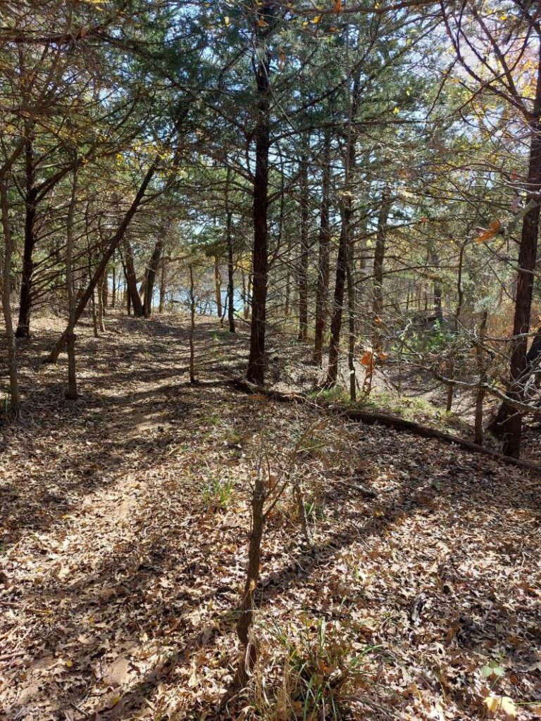
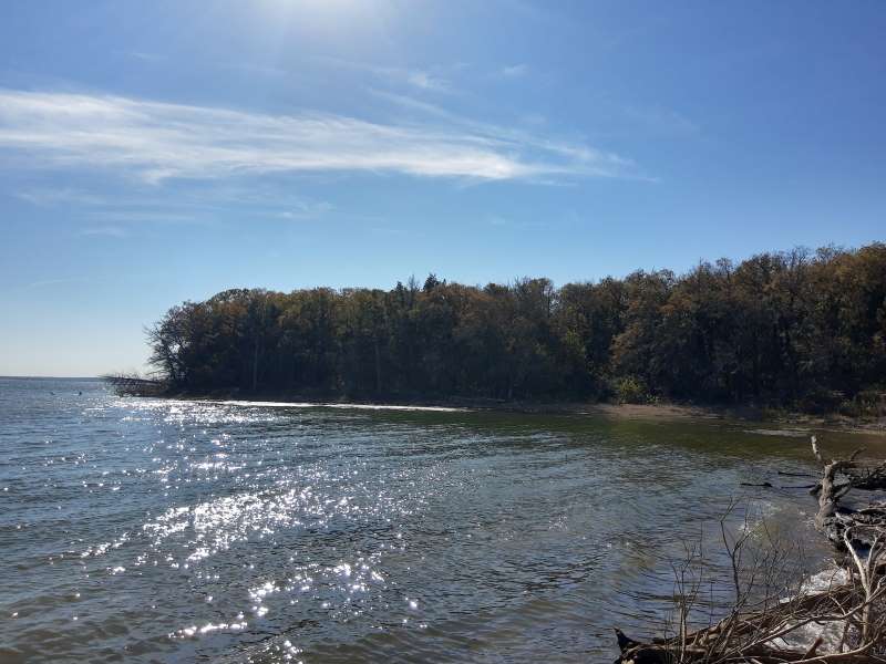
This is a very nice trail with some definite elevation changes here and there. The beginning of the trail winds through a somewhat primitive campground and there were lots of people camping this particular weekend. It looks like a great place to camp if you are into doing it a little ruggedly, as you have to hike in your gear. After getting past the campground, we leveled out onto a very nice and quiet, heavily wooded area. The trail was wide and easy to follow, although we didn’t see any trail markers. However, when you come to a DORBA extension they were well-marked. We followed Dogwood Canyon to the end where it loops around and back onto itself, and there were some great views of the lake here. We stopped at the shore for a picnic lunch and enjoyed a cool breeze and the clear water. After that we finished the small loop and chose to head back on the DORBA red loop. This trail was a bit tricky to see at times as the fall leaves were everywhere on the ground and covered the trail. You have to look carefully to see where the trail goes, but I don’t think there is much chance for getting lost. There is more elevation in this area, with small canyons and forest bottomlands. There were more views of the lake here as well. At the end of the red trail, we decided to take part of the DORBA green extension, where we saw several small ponds. Halfway through the green, we took a small portion of the pink extension to connect to the blue extension, which lead us back to the parking lot. Some of the DORBA trails are a bit confusing on how they are marked, so we did pull out our compass a few times to make sure we were heading in the right direction.
Dogwood Canyon is rated moderate by the park, but we think it was more on the easy side. We would say the DORBA extensions were more on the moderate side, as this is where you saw more elevation change into canyons and valleys. This was a very nice hike and we actually liked it better than Ray Robert’s sister park’s trails at Isle du Bois.
Isle du Bois Unit
Trails: DORBA Trail Loops A, B, C, and part of D
Last hiked December 26, 2021
Trail Type: Hike and Bike
Distance We Hiked: 8.27 miles
Amount of Time it Took Us: 3 hr. 2 m.
Our Elevation Gain: 555 ft.
Park Rating: moderate/challenging
Mike & Elaine’s Rating: easy/moderate
Our Notes:
We began this hike at the DORBA trailhead parking lot. There is no restroom facility here, but there is one in the next parking lot over toward the lake. These are loop trails but near the middle of each there are access points to get onto the next trail.
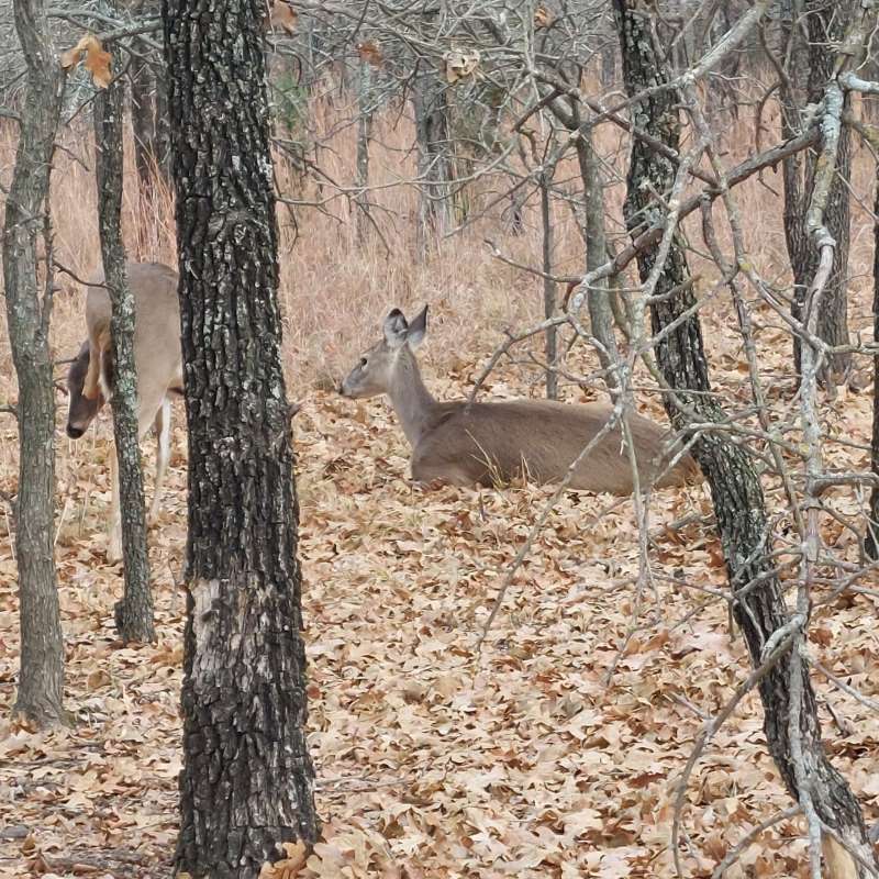
As we stepped on to Loop A, immediately in the brush to the left of the trail we encountered two deer, one sitting down and the other standing and grazing. They did not appear to be afraid of us as they didn’t run away and looked at us like we were invading their territory. They must be used to human traffic. We continued down this portion and were disappointed to notice that this trail runs close to the road on one side and next to the Randy Bell Scenic Trail to the left, which is a paved trail trafficked with bikers, skateboarders, and walkers. We hoped it would get better. Toward the middle of Loop A you have the option to cross the Randy Bell and hop on to Loop B, which unfortunately was quite similar to Loop A. Both of these trails are less than a mile long and great for an easy warm-up, but not really exciting in terrain. The trail loops are so narrow and flat that you see the return path right next to you in many places – not something we like as you know what’s coming and there are no surprises. This trail loops around back to Loop A, but toward the middle of the trail you can cross a road and hop on to Loop C, which is about 4.4 miles if you complete the entire loop. Here you get to see a very bright green pond covered in what I assume is algae or moss. That thing looked nasty! But we saw a cute turtle there. There is a bit more elevation in this area, but nothing too strenuous going out. It was a bit more challenging coming back because we were tired. We hiked to the next trail access point, which was across the Randy Bell again, to Loop D, which totals 7.0 miles in distance if you complete the entire loop. We made it a fair distance down this trail and were rewarded with another deer sighting, but again the terrain was not too exciting because you kept seeing the loop trails next to you going the opposite direction. Of course, these are DORBA trails and really made for bikers, but we’ve been on DORBA trails before for hiking and we’ve never seen the trails this close to each other. After a little more than four miles in, we decided to turn back as it was getting late, but you can choose to continue to the Loop E trail, which we understood from other hikers on the trail had some nice views of the lake in several places. But it is a long way to get there, so leave early and pack snacks and plenty of water.
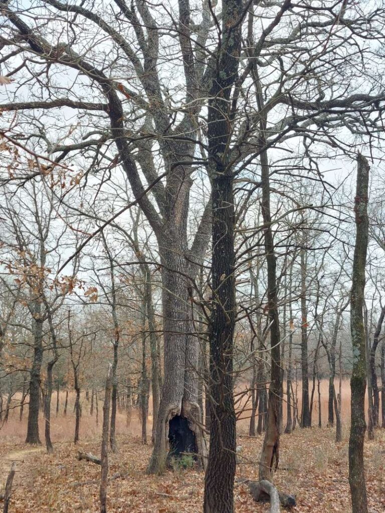
Going in December, the trees had lost most of their leaves and for the most part look dead. We saw several interesting trees that had been struck by lightening or were shaped in unusual ways. That is what kept us entertained on these trails. That and the deer sightings.
Overall this trail system was a bit disappointing to us due to constant switchbacks and little change in terrain. There are hardly any markings on the trail so you really have no idea how far you’ve gone, but it is fairly easy to see the trail. The park rates these as moderate/challenging, but we think they are more along the easy to semi-moderate level for a hiker, as a lot of the trail is flat with packed dirt. There are sections that are moderate in that there are large boulders and rocks to be aware of, so just keep your eyes on your feet in these sections.
Some links below to the park and the trails:
https://tpwd.texas.gov/state-parks/ray-roberts-lake
https://tpwd.texas.gov/publications/pwdpubs/media/park_maps/pwd_mp_p4503_0153b.pdf
https://tpwd.texas.gov/publications/pwdpubs/media/park_maps/pwd_mp_p4503_0137aa.pdf
https://www.alltrails.com/parks/us/texas/ray-roberts-lake-state-park