Purtis Creek State Park Trails
Trails: Wolfpen Red & Blue Loops
Last hiked January 17, 2022
Trail Type: Hiking and Biking
Distance We Hiked: 3.3 miles
Amount of Time it Took Us: 1 hr. 17 min.
Our Elevation Gain: 138 ft.
Park Rating: easy
Mike & Elaine’s Rating: easy
Our Notes:
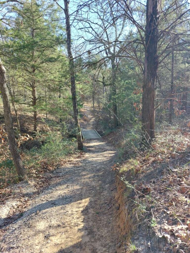
We began our hike at the Wolfpen Hike and Bike Trailhead. There is a parking area here, but no restroom in this area. The trailhead is well-marked.
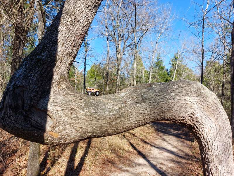
As you enter the trail, you have the option of taking the Blue loop to the left or the Red loop to the right. We took the Red loop first. This is a very flat and compact hiking trail, making it a very easy walk down the path. What’s great about that is you have the ability to walk without making too much noise on this trail. If you are very quiet, you might be rewarded with wildlife sightings. We did very little talking on this hike and had several deer sightings as well as armadillo encounters. This is also a great place for bird viewing, and we heard and saw many species such as the red headed woodpecker, cardinals, hawks and many others. This is a heavily treed path that takes you to the park’s borders, so you get to see rolling farmlands and other properties outside the park at times. Near the end of the Red loop, be sure to be on the lookout for a very unusual 90 degree bent oak tree! We thought that was pretty cool. The Red loop eventually intersects with the Blue loop, which we continued down. This trail is much like the Red loop, but just a bit longer. Both loops offer serenity if you choose to take advantage of the peace and quiet out there.
These trails are rated easy by the park, and we agree. It is just a lovely, easy walk in the woods and a very enjoyable one at that!
Trails: Beaver Slide Nature Path
Last hiked January 17, 2022
Trail Type: Hiking
Distance We Hiked: 1.93 miles
Amount of Time it Took Us: 43 min
Our Elevation Gain: 124 ft.
Park Rating: easy
Mike & Elaine’s Rating: easy
Our Notes:
The Beaver Slide Nature Path is located at the end of the park and is for hiking only. There is a parking lot at the trailhead, but the bathrooms are a short hike around the curve toward the camping area. The trailhead is well-marked.
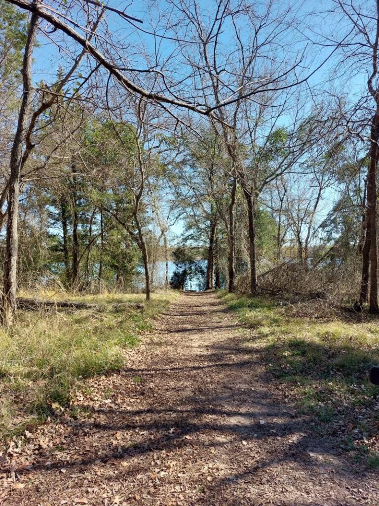
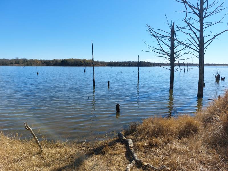
This trail is a bit different from the Wolfpen loops. First, no bikes on this one, which is nice. It is also the location of the primitive camping area. We made our way down the trail, which is very easy to follow, and right away encountered views of the lake’s inlet. There are a few bridges to cross as you make your way around the inlet and toward the lake itself. Before you get there, however, you pass a bird blind right on the inlet, which is a nice place to stop for a bit and possibly see bald eagles, which nest in the area, or white pelicans and other species of birds. From there you can continue to a bridge where you can either go left or right to make a loop. We went left and passed a bench and camping outhouse located there for the primitive campers. The trail rounded out and passed each primitive campsite, which were nice to walk out to as they are right on the lake and you have wonderful views in each of these sites. We finished out the loop and made our way back the way we came to the trailhead.
This hike is also considered easy, like the others in the park, and we agree. It was just a nice, easy stroll through the woods and a great opportunity, again, to see birds and the lake. Another very peaceful and tranquil experience, and well worth it on a beautiful day!
Links below to the park and trails:
https://tpwd.texas.gov/state-parks/purtis-creek
https://tpwd.texas.gov/publications/pwdpubs/media/park_maps/pwd_mp_p4508_0105h.pdf