Lost Maples State Natural Area
Trails: East Trail, Maple Trail, West Trail
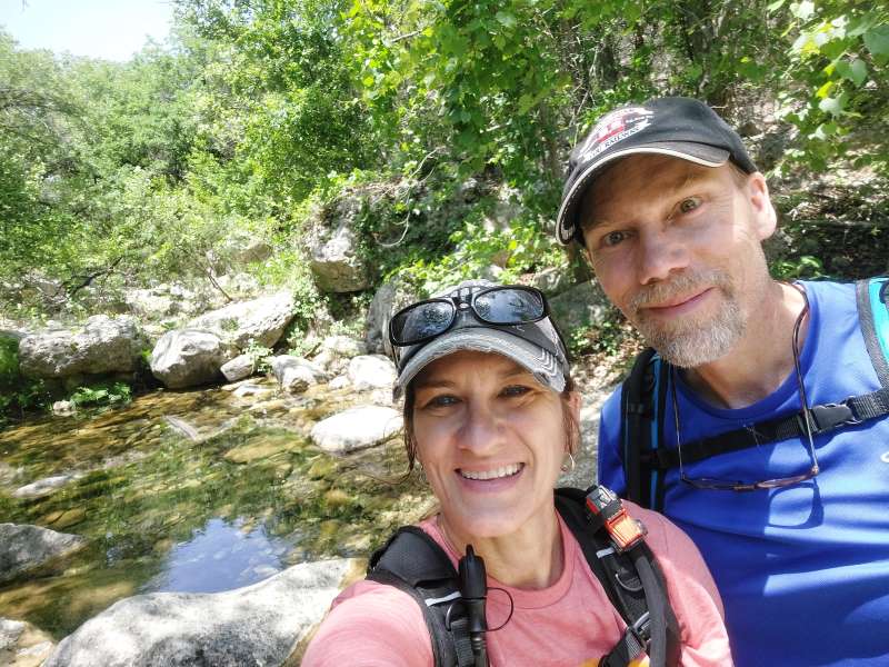
Last hiked May 28-29, 2022
About Lost Maples:
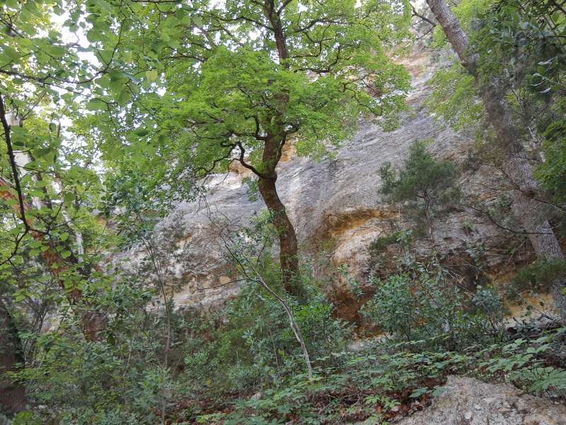
Lost Maples State Natural Area is located in the beautiful rolling hills of the Texas Hill Country. The drive alone to get there is quite beautiful, but once you enter this small park you feel like you are in another world altogether. This natural area is noted for its steep canyon walls, rugged terrain, and protected special strand of Uvalde bigtooth maple trees. There are more than 10 miles of hiking trails that climb down into canyons and valleys and up onto stunning cliff overlooks, one loop in particular reaching a 2,200-foot cliff. Note that there is absolutely no cell coverage while staying in the park and make sure to wear good sturdy shoes and take plenty of water. The trails here are very rocky and not for the weak-of-heart, but the beauty and the wide variety of amazing natural features here are worth every step on the trail.
Trail: East Trail & Maple Trail
Trail Type: Hiking
Distance We Hiked: 6.58 miles
Amount of Time it Took Us: 2 hrs. 26 mins.
Our Elevation Gain: almost 568 ft.
Park Rating: Maple Trail: easy; East Trail: challenging
Mike & Elaine’s Rating: Maple Trail: easy; East Trail: challenging
Our Notes:
On our first day at Lost Maples, after setting up our campsite, we headed out to the Maple Trail trailhead, thinking we’d get a short hike in. The Maple Trail itself is only .4 miles and is considered “easy.” This is where you will be educated on what a bigtooth maple looks like and why this park is so special. The trail is well-marked and easy to follow. Once you complete this short section, then you can continue on to the East Trail, which we did because we were already all-in and just couldn’t stop.
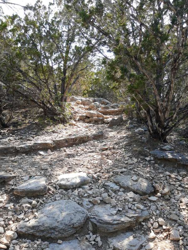
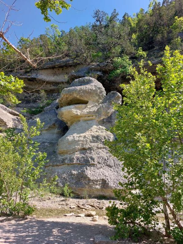
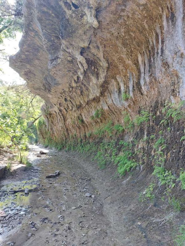
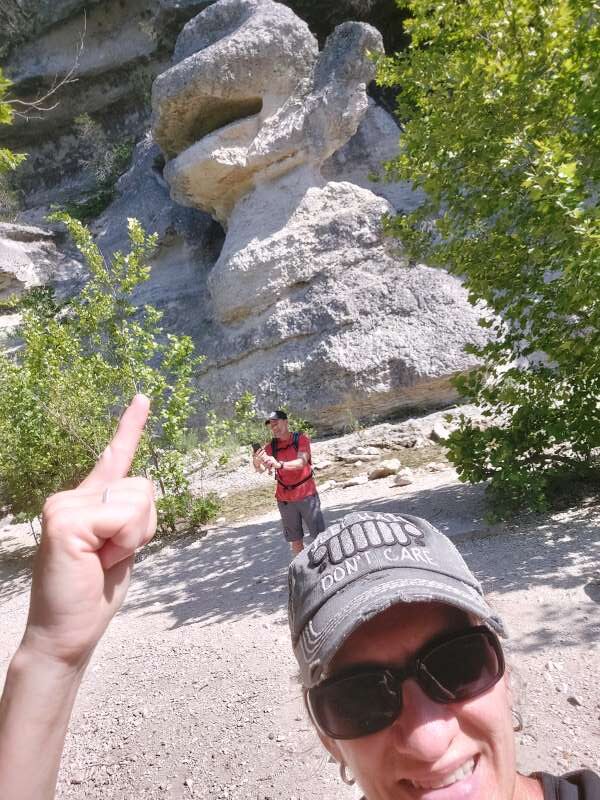
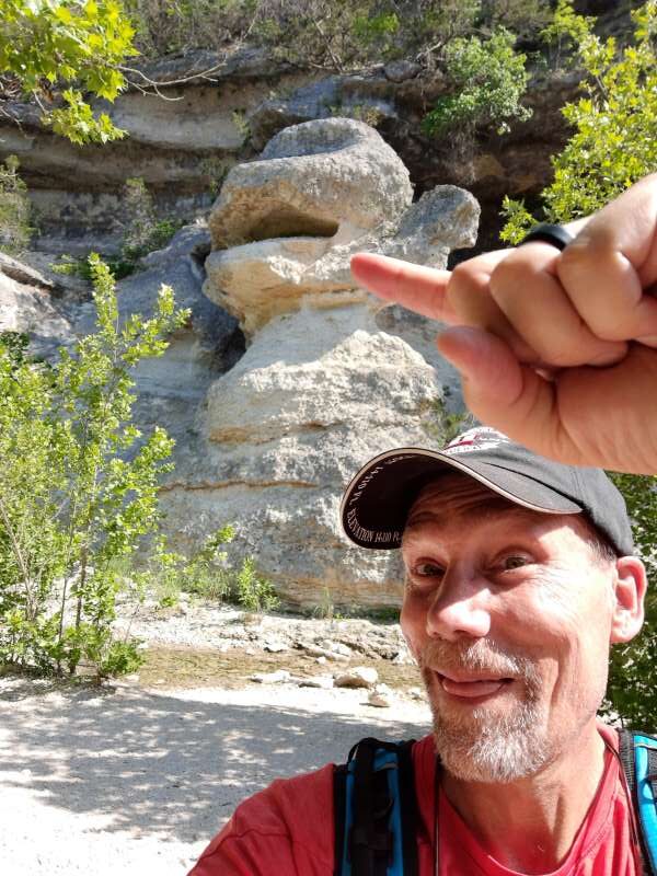
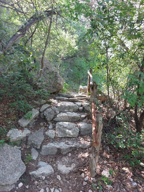
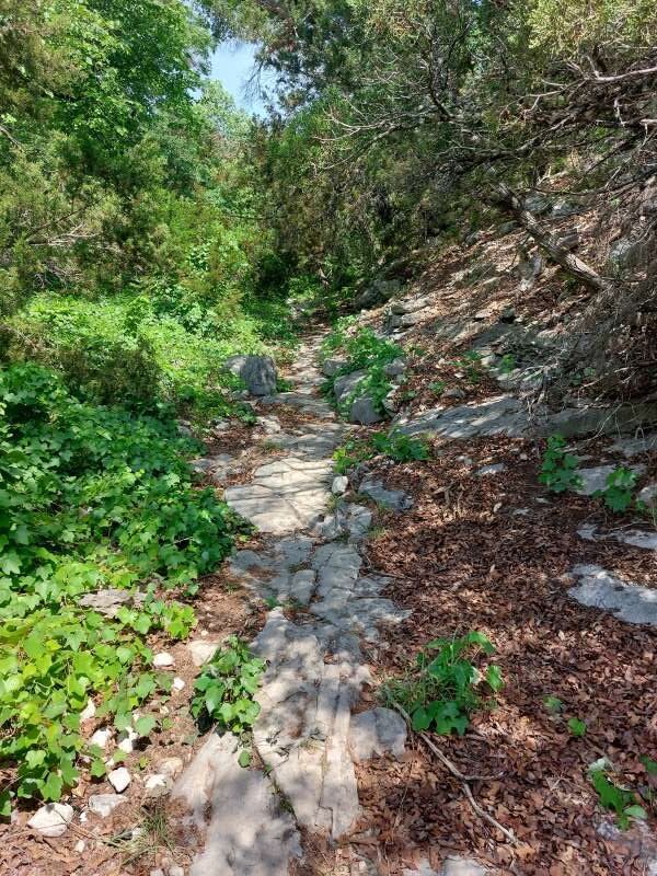
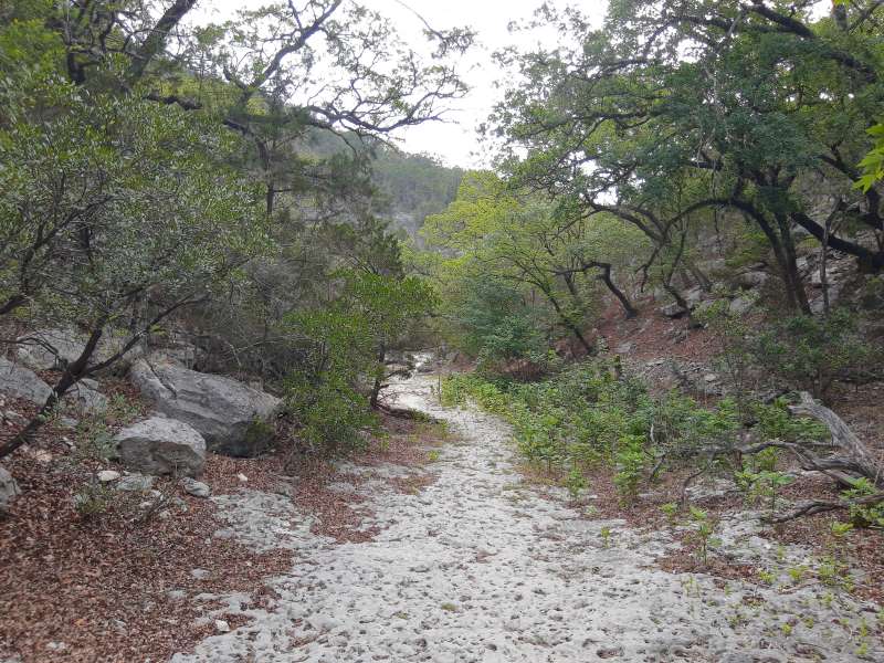
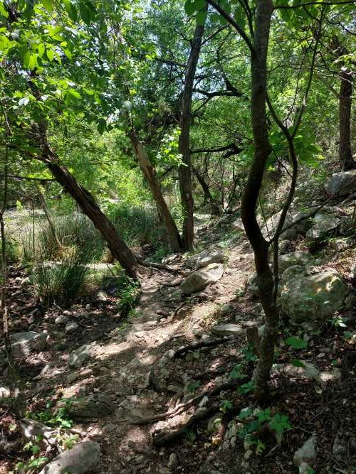
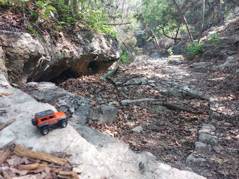
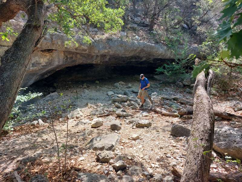
The East Trail has several interesting features to see along the way, which are all noted on the trail map, so make sure to have one of those with you. The first thing we noticed, though, was a sign warning that the trail has portions that are “strenuous due to length and steepness,” which is no joke. The beginning of the trail is relatively flat, but you are mostly walking on loose gravel, stones and rocks for most of it instead of a hard compact dirt floor. It does make it a bit more challenging to keep your footing at times. Many times along the trail you will encounter steps made out of large rocks and boulders. Almost a mile into the East Trail you come upon a very interesting and entertaining formation called Monkey Rock. Do not miss this! You will take a left off the trail at the sign and head down a short way, then meet Mr. Monkey Rock face-to-face. We enjoyed getting some humorous pictures here. It really is amazing what weathering can do to a rock’s surface! After Monkey Rock we hiked back to the main trail and continued on our way past Primitive Campsite A and to feature #2, the Grotto area. This cave-like natural wonder showcases beautiful maidenhair ferns growing on the sides of the limestone walls. There is a bench here to stop, rest, and enjoy the peacefulness and tranquility.
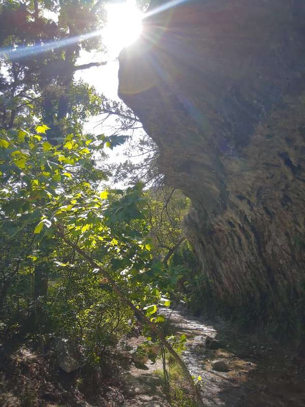
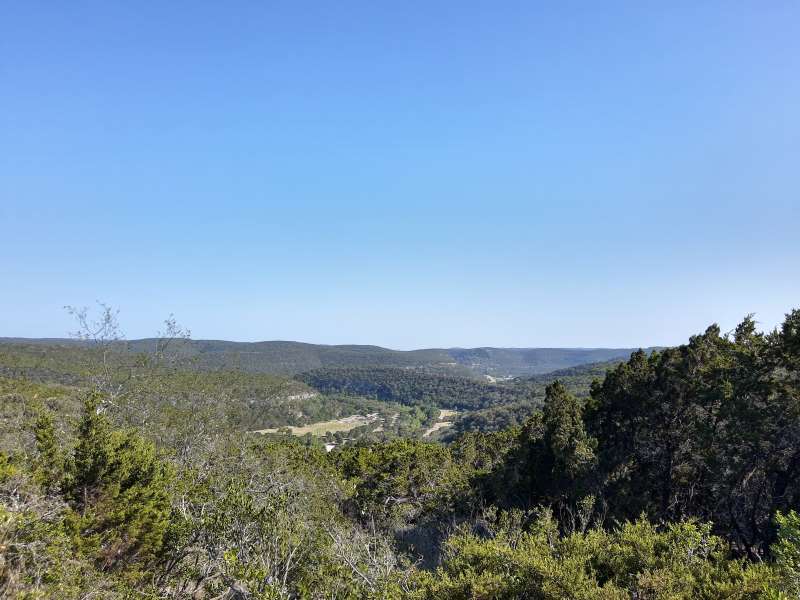
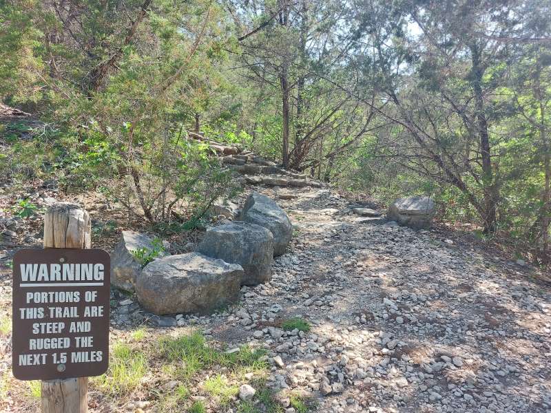
And it is a very good idea to get that rest at the Grotto before heading on, as we soon found out. As we continued down the trail, we came to a sign warning that the next 1.5 miles were very steep and rugged – they were not wrong! It took everything we had, plus stopping often to rest, to get up that incline! The trail here consisted of massive rocks “stair stepping” up from the valley floor to the high cliff above the canyon. Once we reached the top, the very rocky terrain still did not help make the hike much easier. But the views up there were incredible. Once up on level ground and a few steps further up the trail, there is an option to take a side trail to feature #3, which is a scenic overlook. This .3 mile offshoot trail supposedly leads you to a view of the Sabinal River valley, but once we got there we didn’t think the view was that great or worth the extra steps. There were too many trees and vegetation in the way of the view to really get a good look at anything other than a paved road below and the entrance to the park. We continued back to the main trail and instead found our amazing views along the path along the top of the cliffs. The views here were definitely much better than at the scenic overlook.
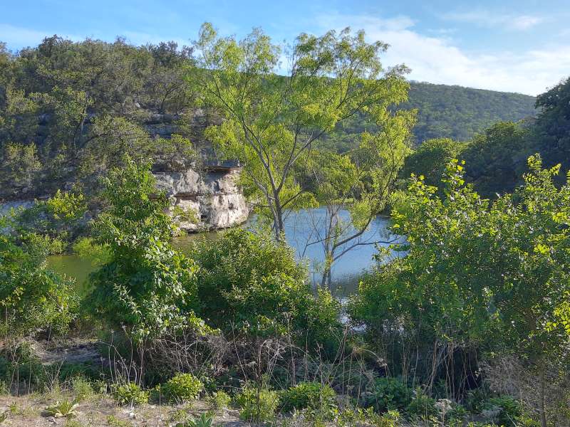
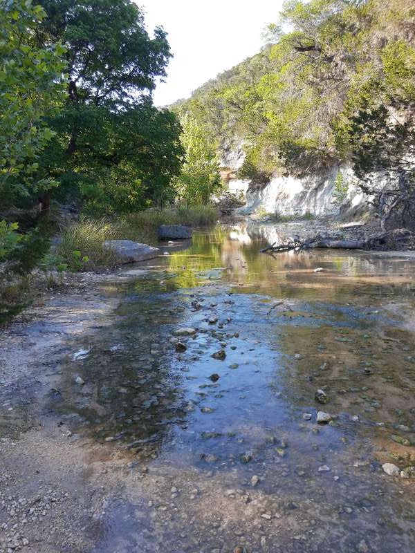
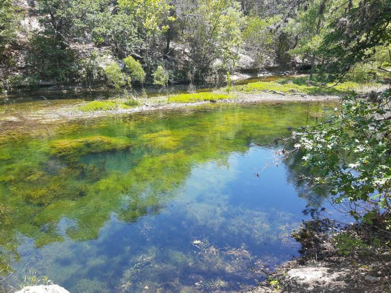
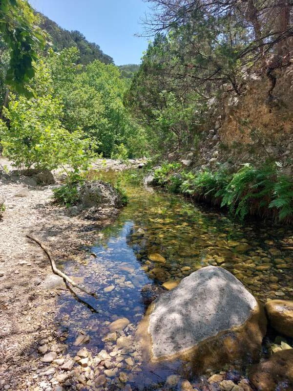
Continuing on, we passed Primitive Campsite B and then began our descent back down into the valley below, which also proved a bit tough as we navigated more large rocks, boulders, and rocky stair steps downward and onward to feature #4, which is the Pond Day-Use Area. This spot is also beautiful, as the water is crystal clear and there are several picnic tables and shaded areas to stop and relax, fish, or enjoy the refreshing water. The high cliffs that surround the pond are a beautiful contrast to the clear blue and green waters below and offer a tranquil rest after a strenuous hike on the East Trail.
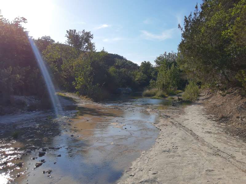
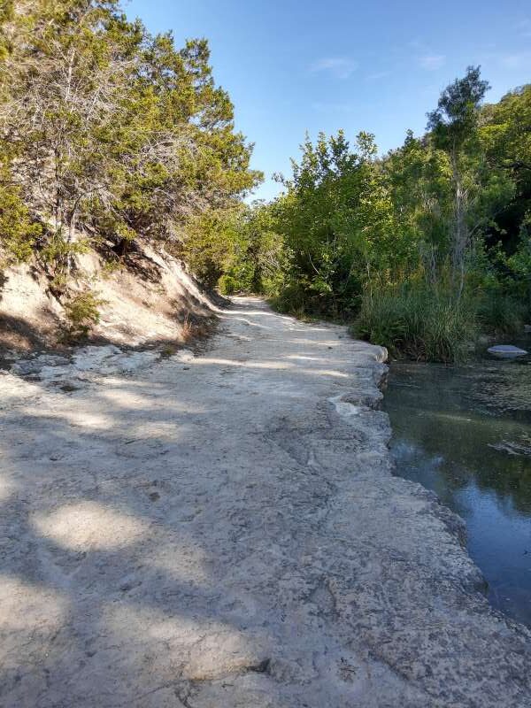
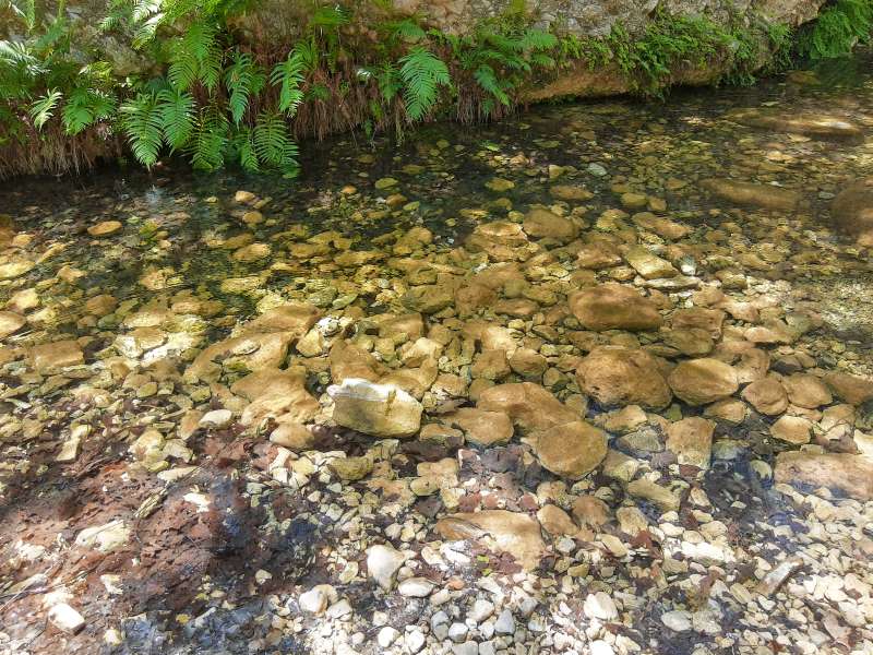
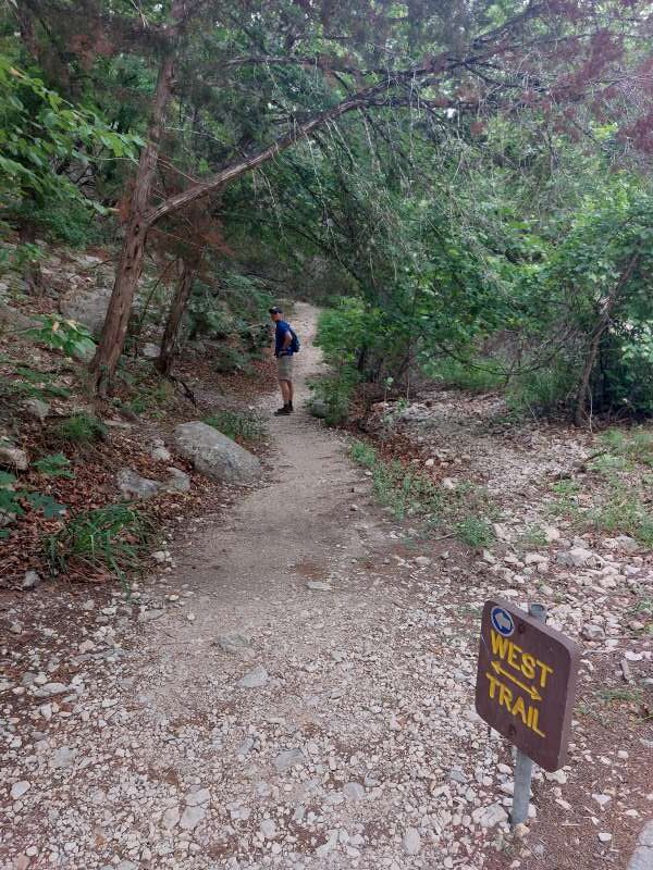
We were quite tired and the day was getting late, so from the Pond Day-Use Area we took the East-West Trail (1 mile) back to the parking area where we started. The remainder of this trail consisted of flatter terrain crossing several shallow rivers with large rocks for crossing and an informational sign showing where a very large hawk nest was located on the side of the cliffs, just to your right as you make your way back. All was extremely beautiful!
This was an amazing and surprising trail in many ways. When we headed out, we originally thought we would just complete a short hike to “get our feet wet” so to speak, but once we got going we just couldn’t stop. There were just too many things to see! We were exhausted, but so glad we completed what we did, because we had much more to see the next day and wanted to make sure we made the most of our visit to this amazing natural area. It was time to head back to our campsite and rest up for our big hike the next day!
Trail: West Trail
Trail Type: Hiking
Distance We Hiked: 7.43 miles
Amount of Time it Took Us: 3 hrs. 5 mins.
Our Elevation Gain: 774 ft.
Park Rating: challenging
Mike & Elaine’s Rating: challenging
Our Notes:
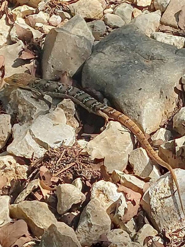
We began West Trail at the Day-Use Parking area, which is next to a really nice wildlife viewing spot. We decided to take the trail clockwise and headed through much of the same type of terrain we had experienced the previous day. We knew we were in for another strenuous hike and we were more prepared this time with plenty of water, snacks, and a can-do attitude! We made several miles past primitive camping areas and up a few steep inclines and met a very interesting large lizard-snakelike looking creature sunning itself on the rocks. He was beautiful and let us get pretty close. Near Primitive Campsite F there is a sign that tells you about Mystic Canyon. Be sure to read about this area. Past here you head downward on the rocky trail into a much cooler and shaded canyon area lush with greenery and limestone overhangs. It was like a whole different world in this section, and a refreshing reprieve from the heat above!
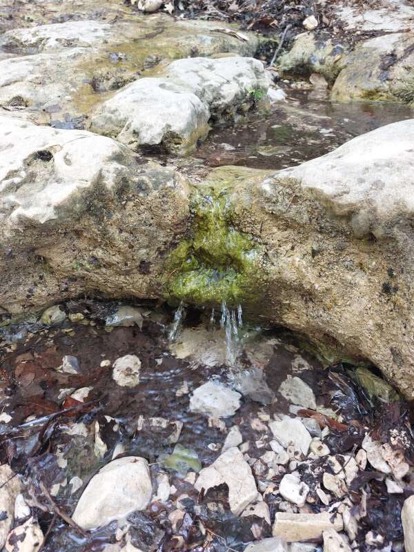
Past Mystic Canyon is a detour that turns off the West Trail and onto the West Loop Trail, which we decided to take. You will hike about half a mile and then take a 1.29-mile loop through a shady Ashe Juniper grove. There are steep inclines and descents here as well. We made our way back to the West Loop Trail and continued about half a mile to a quiet, beautiful natural spring area that is right next to a clear refreshing river. This is a great spot to stop, rest and have a snack.
From there we ventured another half mile back to the Pond Day-Use Area we had passed the day before and connected on to the East-West Trail to take us back to the parking area where we had begun our adventure. The trail here passes over rivers and is more open and less rocky. We came upon a small pond with the brightest blue-green tint we had ever seen before, and so crystal clear that we could see down to the bottom and watch the fish swimming around. That was cool! Onward we headed, and then, before we knew it, we were back at the trailhead, exhausted but completely fulfilled and happy.
Overall, we were very pleased with our hikes on all of the trails at Lost Maples, even though they were among the most difficult we have done yet. We felt very accomplished completing them! And the scenery just can not be measured in beauty. If you decide to visit this area, make sure to make reservations well in advance, as they only allow 250 vehicles in this small park at a time and they have limited parking spaces available. This park is very popular and fills up quickly. This is definitely an adventure we’ll place at the top of our list of best hikes so far!
Links to the park and trails below:
https://tpwd.texas.gov/state-parks/lost-maples
https://tpwd.texas.gov/publications/pwdpubs/media/park_maps/pwd_mp_p4507_0074g.pdf