Cross Timbers Hiking Trail – Rock Creek Trailhead
Trail: Cross Timbers Trail – Rock Creek Trailhead heading East toward Juniper Point Trailhead
Last hiked January 8, 2022
Trail Type: Hiking & Biking (we have hardly ever seen any bikers)
Distance We Hiked in January: 10.17 miles
Amount of Time it Took Us: more than 4 hours
Our Elevation Gain: almost 1,500 ft.
Park Rating: moderate to difficult
Mike & Elaine’s Rating: moderate to difficult
Our Notes:
Cross Timbers is a 14.2 mile out and back trail, and we have hiked it before, but from the Juniper Point trailhead at the east end of the trail (see our write-up about that trailhead below). This time, we began our hike near the mid-point of the trail at Rock Creek Marina. This is a free entrance, but it is a bit confusing to access. We arrived, according to google maps, at the Rock Creek area, but arrived at a gated golf course community and we needed to get through the gate to get to the trailhead. There was a keypad, so we punched the button and told the guard we were there to hike the trail, and he opened the gate for us. From there, we followed google maps to the trailhead, which ended up being a dead-end road with no parking. So, we went a bit further down to the marina area and parked in that parking lot, then walked down the road to the trailhead. There is no sign for the trailhead, but the trail is pretty clear at the end of the road, so it is easy to access. There are no restroom facilities in this area, so be prepared for that.
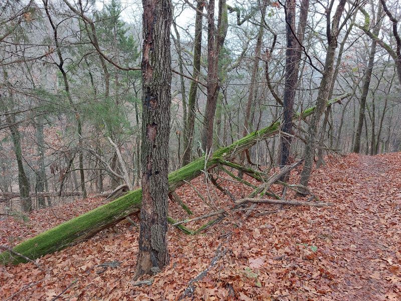
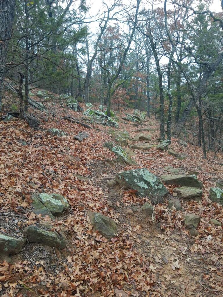
Once we finally got to the trail on this soupy, chilly, and somewhat rainy day, we followed the trail a short distance to what used to be a trailhead check-in station. Usually when you go on a lengthy hike, you need to “sign in” just in case anything happens. This station, once we opened it, did not have any paperwork to fill out and simply had a rusted clipboard and a lot of bugs and decay. That probably needs to be addressed at some point. Anyway, we headed on down the trail and were so pleasantly surprised by what we found here along the way. As Mike stated at one point, “I feel like a kid in a candy store!” There were surprises around each corner on this hike. The forest was beautiful with a variety of oak and cedar trees. It was not a thick forest, so you have great views throughout the vegetation. The trail is very well marked on the trees and there are signs to point the way.
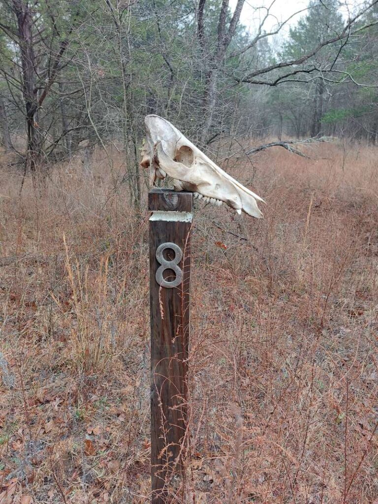
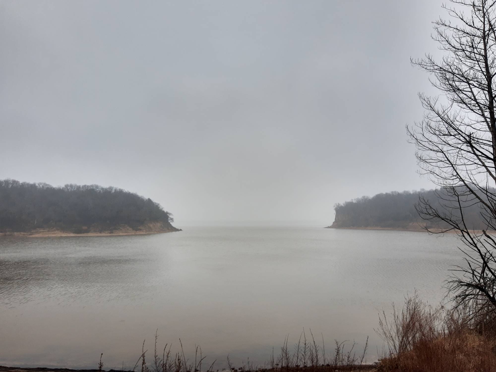
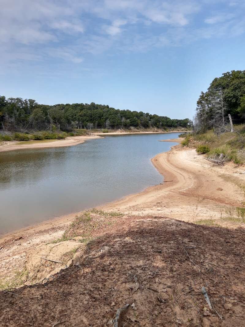
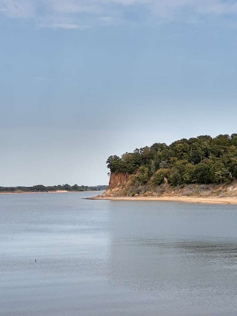
One of the first surprises we encountered was at trail marker 8, which happened to have an animal skull on top of it. No idea what it is, but our guess is a hog because it appeared to have tusks. After saying hello, we went on our way through quite a bit of elevation change. This route follows pretty closely along the lakeshore, so there are some beautiful views. Our goal was to head toward Cedar Bayou. Some of this is a bike trail and you have the option of taking the hiking trail or the biking trail in certain areas. The bike trail is a bit easier to navigate, while the hiking portion tends to have more rocky terrain, so you can decide what you are up for. At one point we went down into a bottomlands area that flattened out a bit more. There was a pretty neat metal bridge that we crossed, and on the other side we saw a sign that stated it was “The Grate Bridge”…I got a laugh out of that. From there we went on to pass a structure that was dedicated in memoriam to a man who loved nature and youth and dedicated the area as a camp. As we ventured on, what we noticed most was the bright green moss that was growing on trees and rocks. It just simply stood out in the earth-colored tones of the rest of the forest.
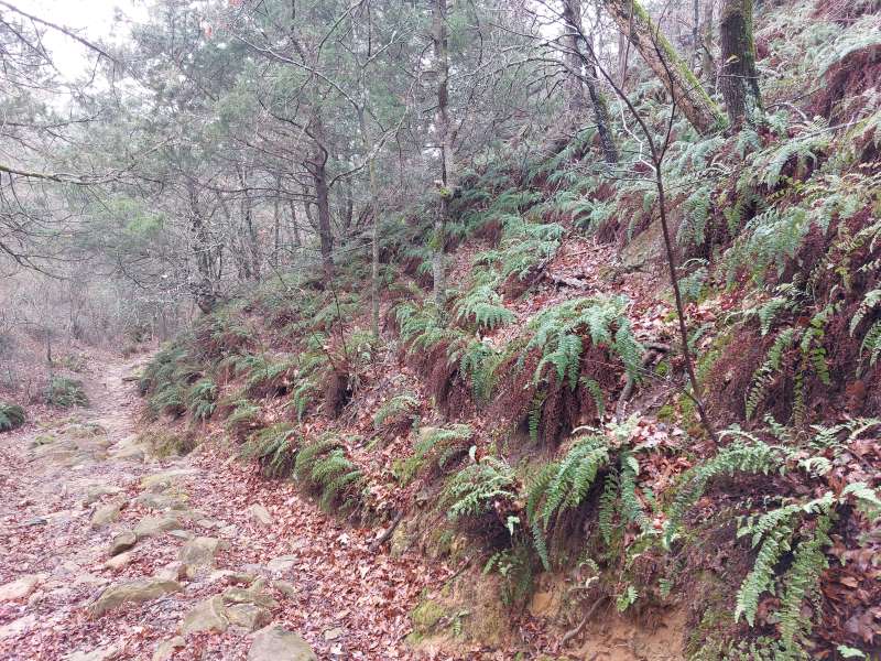
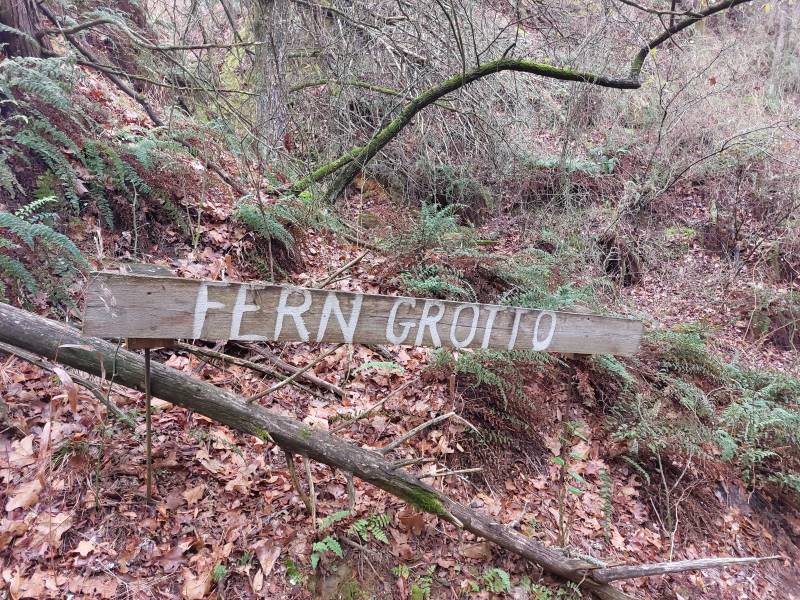
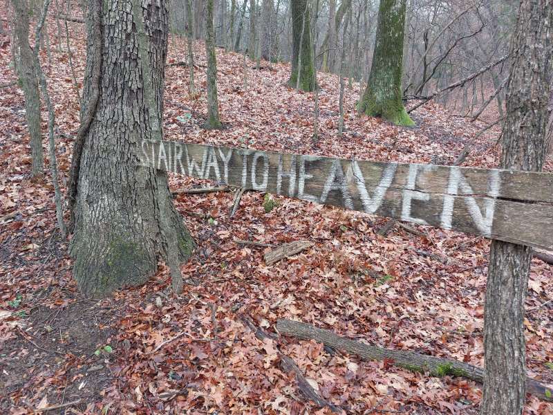
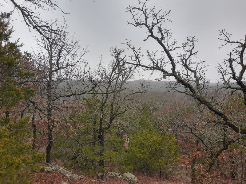
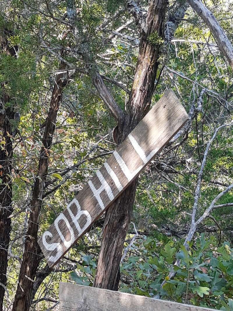
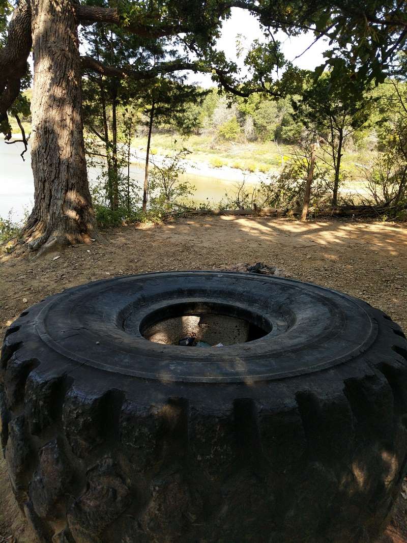
Next we passed an offshoot trail with a sign that said, “Stairway to Heaven.” Mike decided to check it out and only made it a few feet up before he decided he didn’t have the energy for that. He came back to the main trail and we ventured on. Further down the trail we had the choice of continuing on or taking a side trail to Eagle’s Roost, which was about a half mile to a lookout. We decided to take the Eagle’s Roost trail and were so glad we did! When we got there the lookout area was spectacular! It is a primitive camping area, and there was a large log to sit on, so we decided to stop there for our lunch. After eating, we headed back down to get back on the Cedar Bayou trail and continued on, where we crossed Cripple Creek and then came to Fern Grotto. This area is stunning! There were ferns growing everywhere in this low-lying area. It felt like a different enchanted world. I think this was my favorite part of the trail.
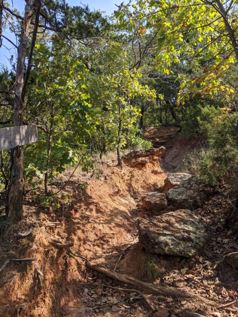
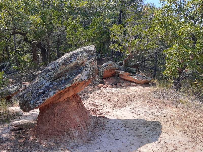
After that, we made it to an area called The Devil’s Backbone, and I could see why they named it that…big rocks and lots of elevation switching back and forth. You need energy for this area, but it is beautiful! There are great views of the lake in this section for sure. After this, we passed a few remote wilderness campsites, and then because it was getting late in the day, we decided to turn around and head back. On the way back, we got a wild hair and decided to try the Highway to Heaven access after all, and as I told Mike on the trail, “Stupid is as stupid does.” It was absolutely hard work, a vertical climb, and on slippery leaves and rocks on such a wet day. Oh well, we did make it to the top, but we were breathing quite hard once we got there. I guess it was worth it. At the top we were able to circle back around to the main trail and then we huffed it back to the trailhead.
This really is an amazing trail with so much to see. The terrain is pretty moderate to difficult, so plan for that, but it is so well worth the effort. This trail is absolutely stunning and beautiful, and we rate it as one of our favorites. We did not encounter any hikers on the trail, so it was very peaceful and quiet on this particular day. Just the way we like it!
Links to trail below:
https://www.alltrails.com/trail/us/texas/cross-timbers-hiking-trail
https://www.laketexomaonline.com/wp-content/uploads/2015/06/cross_timbers.pdf
Cross Timbers Hiking Trail – Juniper Point Trailhead
Trail: Cross Timbers Trail – Juniper Point heading West toward Cedar Bayou, Rock Creek, & Paw Paw
Last hiked December 28, 2020 & October, 3, 2020
Trail Type: Hiking & Biking (we have hardly ever seen any bikers)
Distance We Hiked: 10.38 miles on 10/3; roughly 5 miles on 12/28
Amount of Time it Took Us: over 4 h
Our Elevation Gain: almost 1,000 ft
Park Rating: moderate
Mike & Elaine’s Rating: moderate/difficult
Our Notes:
Cross Timbers is a 14.2 mile out and back trail designed for hiking and biking (but we have never seen any bikers the times we have been on it). There are several areas to hop on this trail, but on these particular days we began at the Juniper Point trailhead. There is no fee to access the trail here and there is a small parking area available with a few picnic tables as well. There are no restroom facilities here, so plan for that. The beginning of this portion of the trail has a lot of elevation gain, along with some absolutely stunning views of Lake Texoma. Be prepared for a workout on this hike!
We have been on this trail a few times and have yet to complete the entire thing. There are several interesting things to see and many wonderful places to stop for a snack, rest, or picnic lunch. There are also several wilderness camps along this trail if you are the rugged camper type. The trail follows the inlets and shoreline of Lake Texoma and offers an abundance of ascents, descents, vistas, twists, and turns. It is also heavily wooded. The trail is well-marked and easy to follow. Be sure to pace yourself and don’t go too far before you turn around, as the way back can be difficult if you are tired.
The trail is rated as moderate, and we certainly agree it is that and more. There is a lot of elevation gain going up and down. It is an absolutely great workout with absolutely spectacular scenery. One of our favorites, to be sure!
Links to trail below:
https://www.alltrails.com/trail/us/texas/cross-timbers-hiking-trail
https://www.laketexomaonline.com/wp-content/uploads/2015/06/cross_timbers.pdf