Clear Creek Nature Heritage Center – Various Trails
Trail: Various Trails
Last hiked January 30, 2022
Trail Type: Hiking & Biking
Distance We Hiked: 6 miles
Amount of Time it Took Us: 2 hrs. 19 min.
Our Elevation Gain: 139 ft.
Park Rating: easy
Mike & Elaine’s Rating: easy
Our Notes:
Clear Creek Natural Heritage Center is a 2,900 acre diverse habitat area with several miles of easy hiking trails. If you arrive on the Collins Road side of the Center, you can pull in through the gate and park in the gravel parking lot next to the Education Center. There is a portable toilet available in this area. The Center is free to visitors.
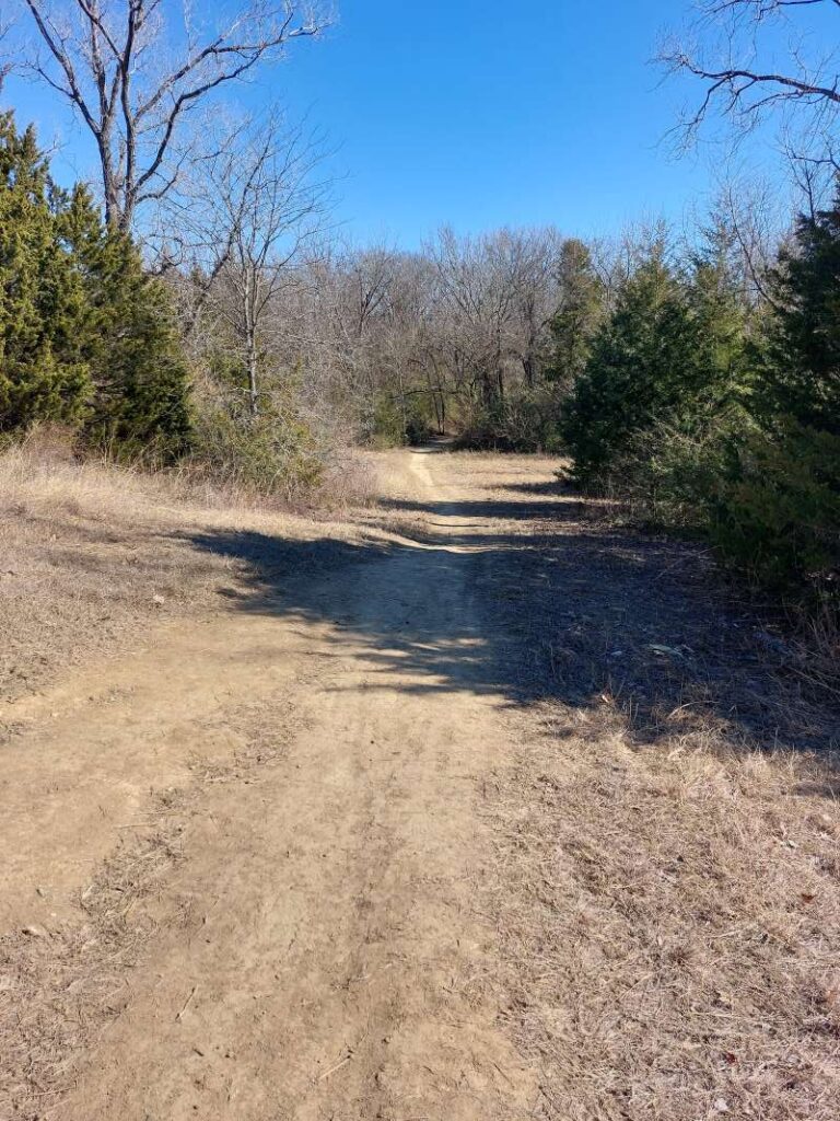
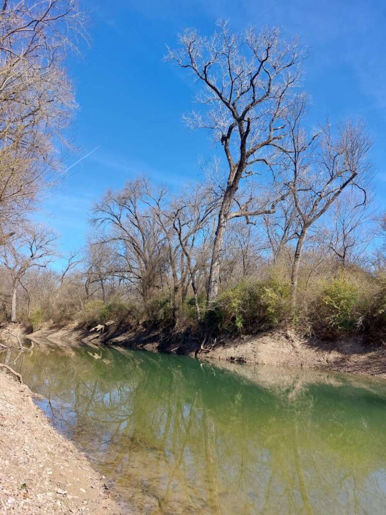
We began our hike going in the clockwise direction starting on the Prairie Trail. At first this trail is pretty wide open and it feels like you are hiking in a big field. But soon enough it narrows into a wooded area as you make your way to the connecting Fisherman’s Trail. You have the option of getting off the main loop and taking an offshoot trail called Big Cottonwood Loop, which we did, and we were so glad we did. This area has huge towering cottonwood trees, and part of it follows Clear Creek to your right. The views of the river here are beautiful – the water is clear and shallow with a sandy bottom.
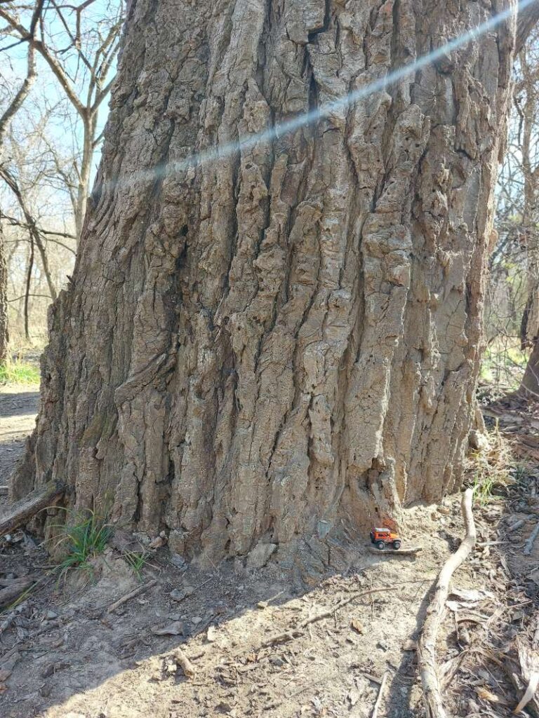
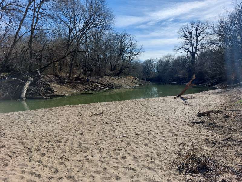
We somehow left the Cottonwood Loop Trail and ended up on another trail that was not marked, nor was it on our map, and the nearest we can guess is that we somehow got on to something called Davis Trail, which takes you out of the Heritage Center. We went down that trail for a while and then decided to turn around and make our way back onto the Big Cottonwood Loop, which led us back to Fisherman’s Trail. We followed that trail to the Bois d’Arc Loop, then took the Path to Confluence. We highly recommend this little offshoot trail, which is only about a quarter mile in and back, as it leads you to a really cool sandy beach area where Clear Creek meets up with the Elm Fork of the Trinity River. Be on the lookout in this area for the largest, most impressive cottonwood tree you might ever see!
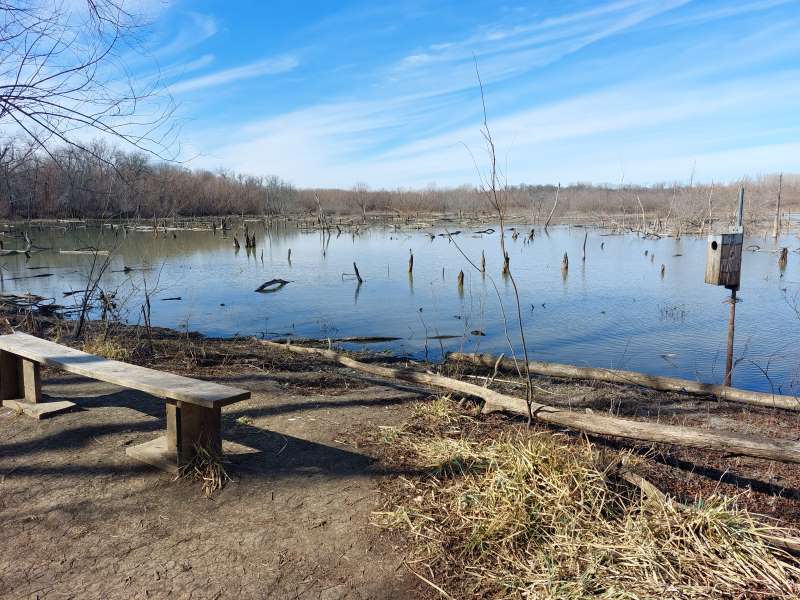
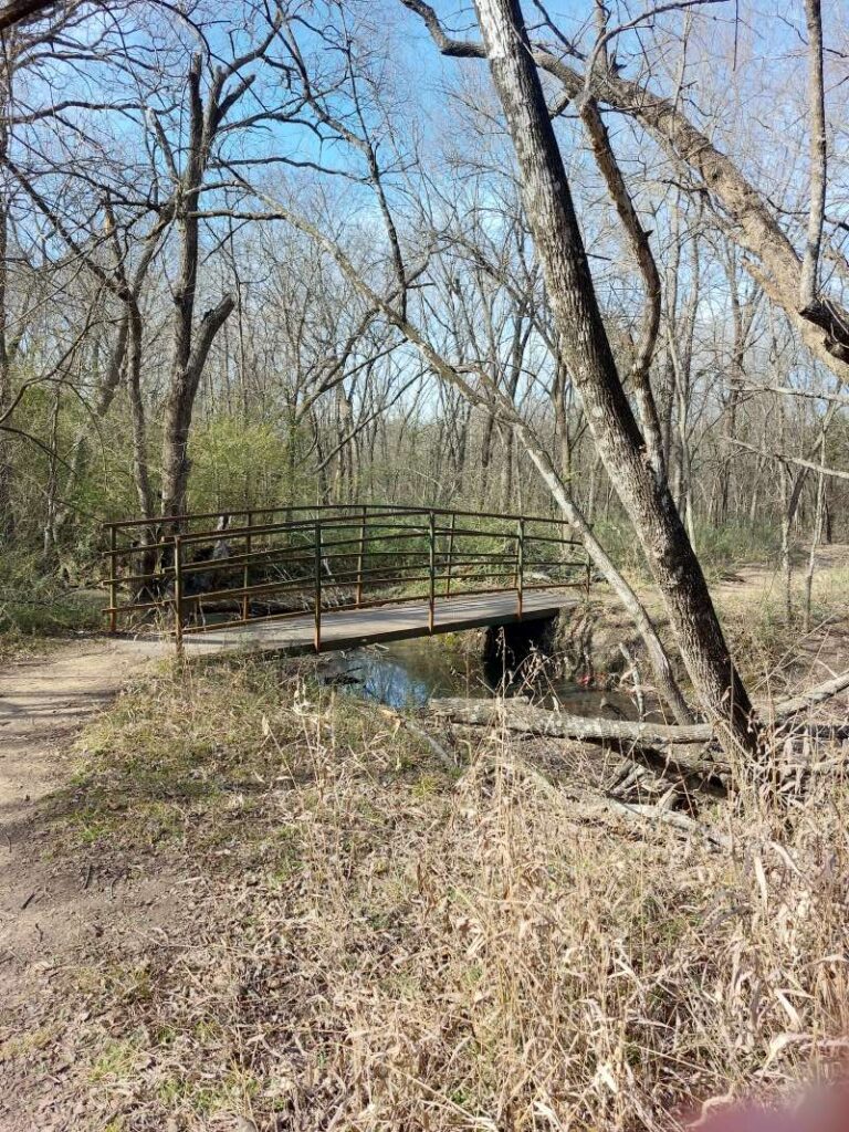
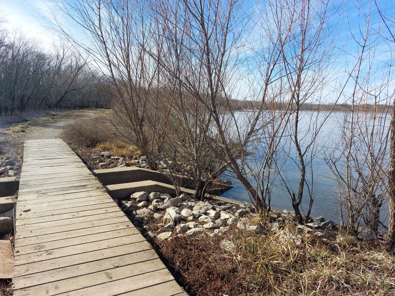
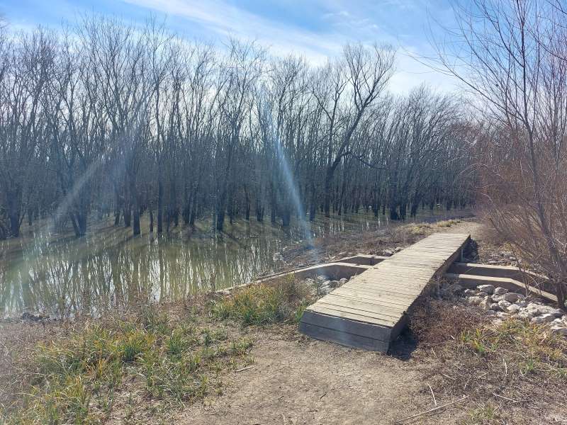
After the Confluence, we headed back onto what became the Wetlands Trail, and this was a nice surprise. At first this trail opened up to what appeared to be a narrow gravel road, but then it passed a very small pond area and the trail narrowed again. Once past that, we reached the larger pond and the wetlands area – this was really cool to see. The pond was on the right and the wetlands poured out onto the left of the trail and was filled with trees. You cross several bridges in this area. This is a really beautiful and unique place and there is a lot of opportunity to see aquatic life here!
The Wetlands Trail loops around to head back to the Education Center parking lot, but if you want to put in a bit more distance, you can take the High Trail, which basically dissects the entire loop trail and leads you back to the Fisherman’s Trail.
All of the above mentioned trails are relatively short in distance, and certainly very easy hiking-wise. We saw a few bikers out as well. The trails are pretty flat and compact. The longest of the trails is the Wetlands Trail at 1.75 miles, but if you make the entire loop you can put in 3-plus miles.
This place is a birder’s paradise so bring the binoculars if that is what you are interested in. All in all, we recommend this place for a nice, easy hike and to see the beauty of some very impressive trees and habitats. From wetlands to bottomland hardwood forest to prairie, this nice natural area has a bit of everything.
Links to trail below:
https://www.cityofdenton.com/222/Clear-Creek
https://www.cityofdenton.com/DocumentCenter/View/261/Clear-Creek-Trail-Map-PDF